event_note History Timeline
1915
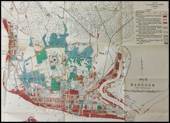
Rangoon 1915
A fascinating map showing Rangoon's social landscape a hundred years ago. According to the map, the 'well to do all races' tended to live south of Government House and around Halpin Road and the Pegu Club down to St John's College and Keighley Street; the Golden Valley estate (the Windermere estate was not yet built) and north of the Royal Lake. The residential areas for "Anglo-Indians and the professional classes, Burmese, Indian, etc" were clustered around York Road and near the Secretariat and east towards Thompson Road.