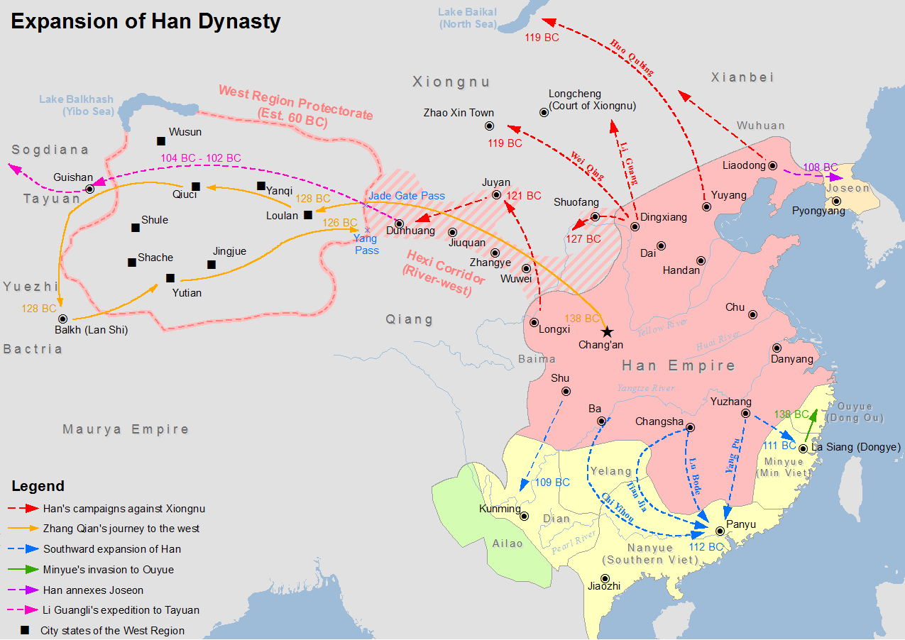
China under the Han Dynasty 2nd century BC
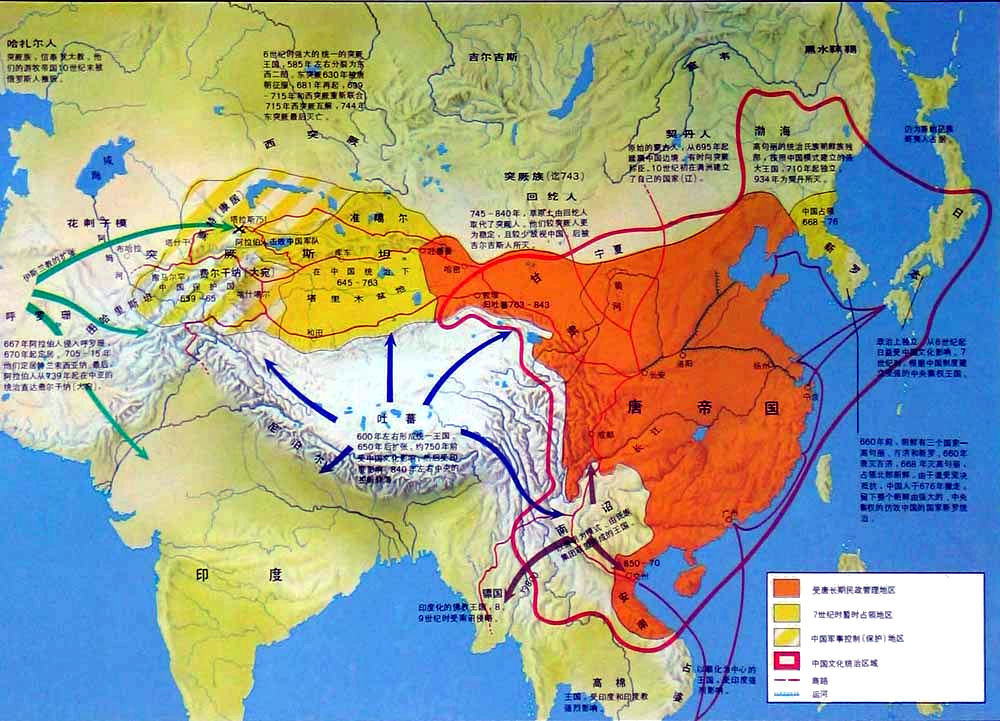
China and neighbouring areas including Nanzhao during the Tang Dynasty (8th c. AD)
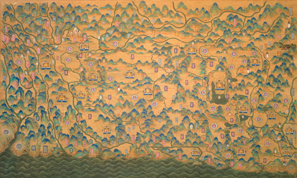
A Qing dynasty (19th century) map of the Burma-Yunnan border (Credit: Eric vanden Bussche)
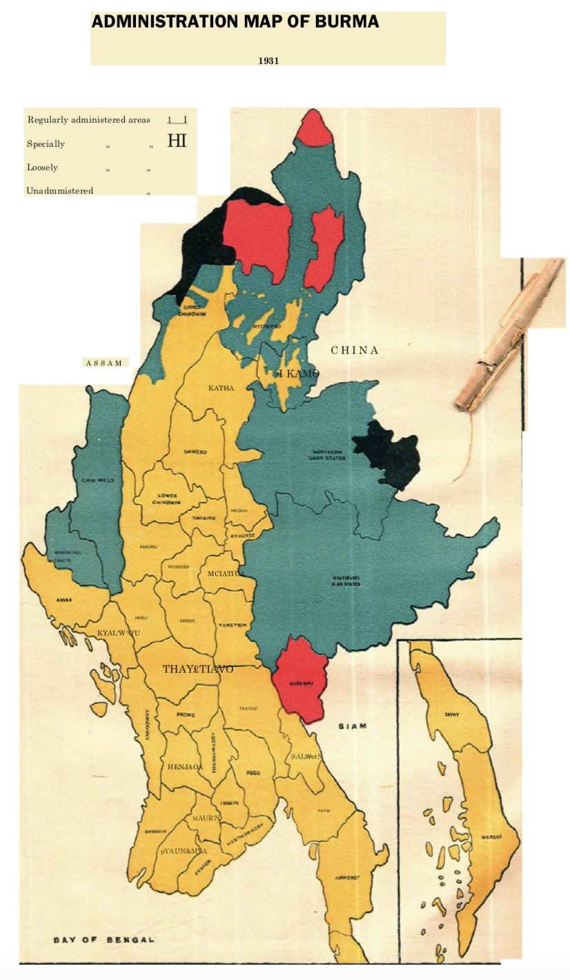
1931 British map of Burma, showing areas not under British administration (red and black)
75 AD - present day
A short history of the China-Myanmar border
room China
Many different peoples, with very different cultures and speaking different languages have lived for tens of thousands of years in the areas along what is today the China-Myanmar border. About 2,000 years ago, during the time of the first urban civilizations in the Irrawaddy valley, much of what is today eastern Yunnan was ruled by the Dian Kingdom. The Dian kings likely spoke a language related to Burmese, but it is uncertain. Other peoples in Yunnan spoke other Tibeto-Burman languages as well as Tai and Austroasiatic languages (related to modern Mon).
In 75 AD, the Chinese Emperor Ming of the Han Dynasty established the Yongchang commandery (near where Muse and Ruili are today). The core areas of Chinese civilization were then very far away and almost no Chinese speakers lived in today's Yunnan. The Chinese hope was to control lucrative trade routes from China across Yunnan to the Irrawaddy valley and then to India.
From around 600 to 1,200 AD, Yunnan was ruled by non-Chinese kingdoms: Nanzhao and Dali. The rulers likely spoke languages related to Burmese. Nanzhao also ruled much of today's northern Myanmar. In the late 13th century, all of Yunnan and then northern Myanmar were conquered by the Mongols.
Chinese rule of Yunnan really began only with the Ming dynasty (14th-17th centuries). It was during this time that large numbers of Chinese people began settling in Yunnan as well as what is today eastern Shan state, as merchants and especially to work in the silver mines. The Wa Hills, in particular, were critical sources of silver for the Chinese economy. At that time, Burmese kings only ruled parts of the Shan state, and only indirectly through local chiefs. Chinese rule in western Yunnan was also mainly direct, through local chiefs. At times, however, Chinese military forces entered what is today northern Shan State and, in 1650, almost taking Ava itself.
In the 1600s, much of what is today China came under the rule of the (non-Chinese) Manchus, and the Manchu Empire attempted several unsuccessful invasions of Myanmar in the late 1700s.
By the 1800s, about a third of Yunnan's population was Chinese (the total population of Yunnan was about 4-5 million people, about the same as all of Burma at the time). The rest were either indigenous people (like the Tai or Naxi) or were descendents of central Asian Muslims who settled in Yunnan during Mongol times. These Muslims were known to the Burmese as Panthay in the 1850s and they established an independent kingdom based at Dali. This kingdom was eventually crushed by the Manchus, with tens of thousands of Panthay fleeing to the northern Shan state and Mandalay.
When the British took over Mandalay they had to decide where the border with China should be. The Chinese claimed vast areas of today's northern Myanmar. But neither the Burmese kingdom nor Chinese (or other) empires had ever really governed most of the areas along today's border. The current border is more or less what was agreed between the British in Calcutta and the Manchus in Peking. Most of eastern Shan state fell within the new British Burma but was only lightly administered by the British. Some areas, like the Wa Hills, were never administered by the British.
During World War Two, all of today's Kachin and Shan states were the scene of heavy fighting between Chinese and Japanese armies, involving hundreds of thousands of troops with decisive battles fought right along the border as well as in western Yunnan. After Burma's independence from the British, the Kuomintang (KMT) invasion of the 1950s made impossible any normal government throughout the border areas. In 1960, the Burmese and Chinese governments signed a treaty demarcating the border. But communist invasions in the late 1960s meant these border areas were the scene of often intense fighting and civilian displacement until the ceasefires of 1988-1994.
At the same time, Yunnan came under far more direct Chinese rule than ever before in its history. The majority of people in Yunnan were also Chinese for the first time ever, with about 40 percent being indigenous peoples.
Since the 1990s, the Chinese government has worked hard to integrate Yunnan economically and to improve transport infrastructure. A hundred years ago travel from the Myanmar border to the Chinese cities of Chongqing and beyond might have taken one-to-two months, over many great rivers and heavily forested mountains. Soon it will be less than half a day by train.
Today, China's economic influence now extends across the Irrawaddy valley and China is closer to Myanmar than ever before. In 75 AD, the Chinese authorities tried for the first time to establish control over what is now the China-Myanmar border. With this new era of Chinese expansion, a 2,000 year old wish is coming closer to reality.
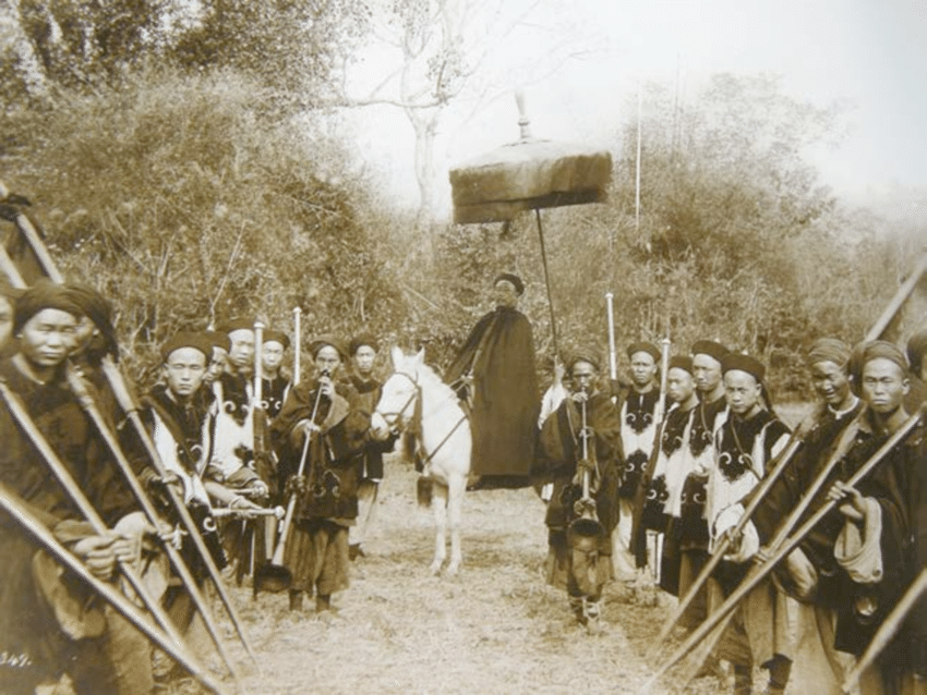
The first photograph shows a Chinese official of the China-Burma Boundary Commission c. 1899, and various maps showing the changing allegiances of the border area.