event_note History Timeline
1760
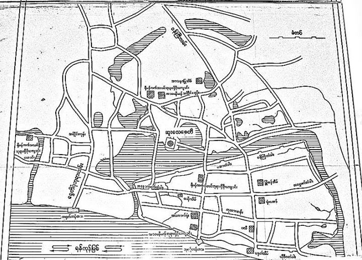
Yangon c. 1760
The map shows the old town to be more or less an island, with the Sule Pagoda across a bay on a small promontory to the north. The town was surrounded by teak stockade 12 feet high, with several gates and two brick roads (the Shwedagon Pagoda Road and Minister's Road) both eventually leading to the Shwedagon (with forests and tigers in between).The old town included (Portugese) Roman Catholic and Armenian churches as well as a mosque, and a governor's house and court. The Armenian cemetery was just outside the town, approximately where Yaw Mingyi Street (York Road) is today. It would be fascinating to see what might still lie beneath modern Yangon.